
Official Discussion issued by the National Hurricane Center
(AL092026) DATA RELEASED: 10/10/2026 4:00:00 PM UTC
|
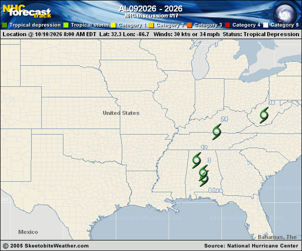
Copy of official data Post-Tropical Cyclone Isaias Discussion Number 17 NWS Weather Prediction Center College Park MD AL092026 400 PM CDT Sat Oct 10 2026 Key Messages: 1. Heavy rainfall associated with Post-Tropical Cyclone Isaias will continue across the Southern Appalachians and Southeast today. Considerable flash and urban flooding will be possible. Landslides are also possible across the Southern Appalachians. 2. Strong wind gusts continue to pose a threat across the southeastern United States today, particularly near the southern Appalachians. Scattered power outages and downed trees and powerlines may occur, with the risk highest in elevated terrain. 3. Swells from Isaias will continue to affect much of the Gulf coasts of the United States, Mexico, and western Cuba this weekend. These swells are likely to cause life-threatening surf and rip current conditions. Please consult products from your local weather office. 4. A couple of tornadoes are possible today across eastern Georgia and the Carolinas. FORECAST POSITIONS AND MAX WINDS INIT 10/2100Z 33.5N 86.9W 25 KT 30 MPH...POST-TROPICAL 12H 11/0600Z 35.2N 86.0W 25 KT 30 MPH...POST-TROP/INLAND 24H 11/1800Z 37.9N 81.9W 25 KT 30 MPH...POST-TROP/INLAND 36H 12/0600Z...DISSIPATED $$ Forecaster Roth |